i-5 Sacramento
Traffic Maps by Cross Streets ...
 
> Airport Blvd
> Elk Grove Blvd
> Florin Rd
> Garden Hwy
> i-80
> i-80 Bus. Loop
> Laguna Blvd
> Lincoln Hwy
> Pocket Rd
> Seamas Ave
> 50 Hwy
> 80 Interstate
> 99 Hwy

SEE MORE TRAFFIC MAPS ...


Interstate 5 Sacramento Traffic
Google


i-5 Sacramento Traffic ...


On page load traffic map is centered on i-5 at 50 Hwy / i-80 Bus. Loop ...
use elevation controls to zoom map
.


Zoom Traffic to:


> i5 at Airport Blvd
> i5 at Elk Grove Blvd
> i5 at Florin Rd
> i5 at Garden Hwy
> i5 at i-80
> i5 at i-80 Bus. Loop
> i5 at Laguna Blvd
> i5 at Lincoln Hwy
> i5 at Meadowview Rd
> i5 at Pocket Rd
> i5 at Seamas Rd
> i5 at 50 Hwy
> i5 at 80 Interstate
> i5 at 99 Hwy

SEE MORE TRAFFIC MAPS ...


Click traffic signs on map below to zoom traffic ...
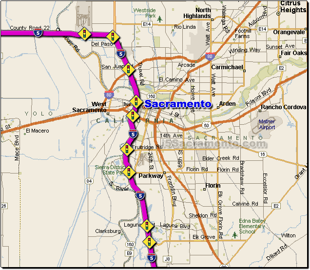
Airport Blvd Highway 99 i-80 Capital Mall Capital City Freeway Seamas Ave Florin Road Laguna Blvd Elk Grove Blvd Interstate 5 Sacramento Traffic Road Route Map


SEE ALSO:

i-5 California ...


i-5 Highway ...


i-5 News ...


i-5 Weather ...


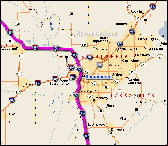
i-5 Sacramento Area Map ...


I-5 Sacramento Map
The Interstate 5 in Sacramento is the main interstate highway that travels generally in a north-south direction through the metro Sacramento area... shown above is a map where the i-5 (highlighted in pink) travels through the metro Sacramento area.

The i-5 is the main interstate highway route south to Los Angeles from Sacramento... traveling from Sacramento to Los Angeles, LA is located 386 miles to the south, estimated driving time from Sacramento to LA along the i-5 is 5 hrs. and 26 minutes.


Copyright i5Sacramento.com ... Privacy Policy, Contact, & Disclaimer